PrimaryGeoRadialSearch Task
![]()
![]()
|
PrimaryGeoRadialSearch Task |
|
|
|
|
The PrimaryGeoRadialSearch task is used to add and edit arguments for the PrimaryGeoRadialSearch command used in a logic template. Performing a PrimaryGeoRadialSearch task consists of the following steps:
Step 1
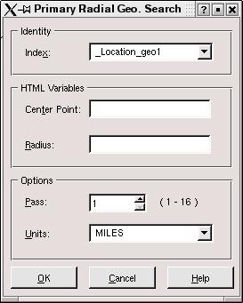
The first step is to initiate the task by either selecting the Geo-Spatial->Primary Radial task in the SEARCHING task bar along the left side of the Logic Template editor or by double-clicking on the PrimaryGeoRadialSearch command name in the logic template if a PrimaryGeoRadialSearch already exists. If the Geo-Spatial->Primary Radial task is not enabled, be sure there is at least one primary geo-spatial index defined in the related load definition file for this logic template.
The PrimaryGeoRadialSearch dialog box will appear:
Step 2
The second step is to select the Index for the command:
|
|
The Index drop-down list will contain only primary geo-spatial indexes defined in the related load definition file. |
Use the Index drop-down list to select the primary geo-spatial index to be searched.
Step 3
The third step is to specify the Center Point for the command:
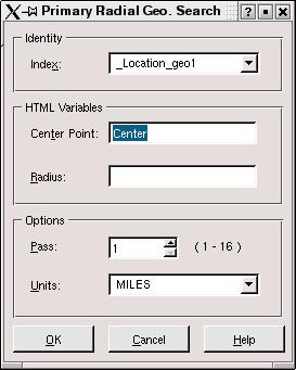
Use the Center Point edit box to specify the HTML variable containing the coordinates of the center of the circle.
Step 4
The fourth step is to specify the Radius for the command:
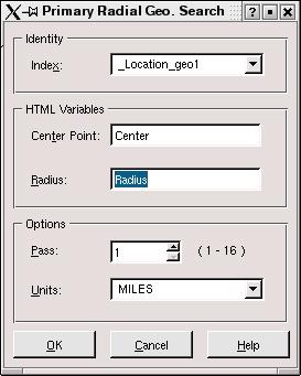
Use the Radius edit box to specify the HTML variable containing the radius of the circle.
Step 5
The fifth step is to specify the Pass for the command:
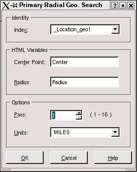
Use the Pass edit box to specify the pass during which the search is to be executed.
Step 6
The sixth step is to specify the Units for the command:

Use the Units drop-down list to select the units to be used ( MILES or KILOMETERS ) for the radius.
Step 7
The seventh step is to click the OK button to insert the command into the logic template:
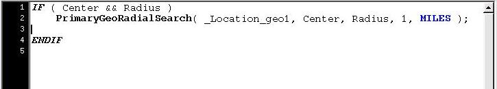
The command is inserted into the logic template where the cursor is located. If the task was initiated by double-clicking on the command name, then the arguments that are changed will be overwritten.
|
|
|